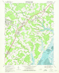
1968 Map of Accomac
USGS Topo · Published 1971About this map
The Eastern Shore of Virginia in the late 1960s was defined by a patchwork of small communities and agrarian land bounded by tidal waters. The Penn Central railroad corridor serves as the primary spine of the landscape, connecting established settlements like Accomac, Onancock, and Onley. Many of these towns show a dense clustering of family dwellings and public landmarks, including St Peters Ch and the Walker Sch. Surrounding these hubs are several smaller locales such as Ticktown, Graysville, and Chancetown, which reflect the localized settlement patterns of the era.
Find a feature on this map
62 named features on this map. Tap any name to fly to it.
Don’t see what you’re looking for? This feature index may not catch every label — zoom into the map to look around manually.
Map Details
Editions of this 1968 Accomac Map
Other maps of this area

1903 · Crisfield
USGS Topo · 1:62,500

1920 · Crisfield
USGS Topo · 1:62,500

1931 · Accomac
USGS Topo · 1:48,000

1935 · Accomac
USGS Topo · 1:62,500

1942 · Chesconessex
USGS Topo · 1:31,680

1942 · Mappsville
USGS Topo · 1:24,000

1942 · Parksley
USGS Topo · 1:24,000

1943 · Pungoteague
USGS Topo · 1:31,680

1943 · Parksley
USGS Topo · 1:31,680

1943 · Mappsville
USGS Topo · 1:31,680