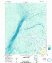
1968 Map of Chesconessex
USGS Topo · Published 1992About this map
Pocomoke Sound and the northern reaches of the Chesapeake Bay dominate this coastal landscape, revealing the intricate bathymetry of the Virginia Eastern Shore. The map details a complex network of marshes and tidal guts, such as Back Way Gut and Canoe Island Gut, which separate small landmasses like Tobacco Island and Savage Island. The settlement of Chesconessex serves as the primary landward anchor, where the terrestrial world meets the salt marsh and shallow flats. Notable for local history and genealogy, the map identifies specific community landmarks including Leatherbury Ch and New Testament Ch. The inclusion of the Factory Boat Ramp and numerous Light markers across the Guilford Flats underscores the area's deep-rooted reliance on maritime navigation and the seasonal rhythms of the bay's seafood industry.
Find a feature on this map
30 named features on this map. Tap any name to fly to it.
Don’t see what you’re looking for? This feature index may not catch every label — zoom into the map to look around manually.
Map Details
Editions of this 1968 Chesconessex Map
3 editions found
Other maps of this area

1903 · Crisfield
USGS Topo · 1:62,500

1920 · Crisfield
USGS Topo · 1:62,500

1931 · Accomac
USGS Topo · 1:48,000

1935 · Accomac
USGS Topo · 1:62,500

1942 · Chesconessex
USGS Topo · 1:31,680

1942 · Nandua Creek
USGS Topo · 1:24,000

1942 · Great Fox Island
USGS Topo · 1:24,000

1942 · Tangier Island
USGS Topo · 1:24,000

1942 · Saxis
USGS Topo · 1:24,000

1942 · Parksley
USGS Topo · 1:24,000