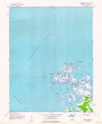
1942 Map of Chesconessex
USGS Topo · Published 1962About this map
Chesconessex and its surrounding marshlands are documented here as they appeared during the early 1940s, based on Army Map Service surveys. Located where the Chesapeake Bay meets Pocomoke Sound, the landscape is a complex network of tidal guts and islands, including Savage Island and Russell Island. The settlement pattern is concentrated near the mainland's edge, anchored by local landmarks like Leatherbury Church and the protected waters of Chesconessex Creek.
Find a feature on this map
24 named features on this map. Tap any name to fly to it.
Don’t see what you’re looking for? This feature index may not catch every label — zoom into the map to look around manually.
Map Details
Editions of this 1942 Chesconessex Map
2 editions found
Other maps of this area

1903 · Crisfield
USGS Topo · 1:62,500

1920 · Crisfield
USGS Topo · 1:62,500

1931 · Accomac
USGS Topo · 1:48,000

1935 · Accomac
USGS Topo · 1:62,500

1942 · Chesconessex
USGS Topo · 1:31,680

1942 · Nandua Creek
USGS Topo · 1:24,000

1942 · Great Fox Island
USGS Topo · 1:24,000

1942 · Tangier Island
USGS Topo · 1:24,000

1942 · Saxis
USGS Topo · 1:24,000

1942 · Parksley
USGS Topo · 1:24,000