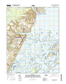
2016 Map of Chincoteague West
USGS Topo · Published 2016About this map
Chincoteague Island and the neighboring salt marshes of the Virginia coast define this 2016 survey, showing a landscape shaped by water and aeronautics. The intricate waterways of Chincoteague Bay and Horntown Bay separate the mainland settlements of Horntown and Sinnickson from the barrier islands. A significant portion of the terrain is dedicated to the Wallops Flight Facility on Wallops Neck, highlighting the area's role in modern space and atmospheric research.
Find a feature on this map
143 named features on this map. Tap any name to fly to it.
Don’t see what you’re looking for? This feature index may not catch every label — zoom into the map to look around manually.
Map Details
Editions of this 2016 Chincoteague West Map
This is the sole edition of this map. No revisions or reprints were ever made.
Other maps of this area

1901 · Snow Hill
USGS Topo · 1:62,500

1942 · Chincoteague East
USGS Topo · 1:24,000

1942 · Mappsville
USGS Topo · 1:24,000

1942 · Wallops Island
USGS Topo · 1:24,000

1943 · Boxiron
USGS Topo · 1:31,680

1943 · Mappsville
USGS Topo · 1:31,680

1943 · Chincoteague West
USGS Topo · 1:31,680
1943 · Girdletree
USGS Topo · 1:31,680
1943 · Hallwood
USGS Topo · 1:31,680
1943 · Pocomoke City
USGS Topo · 1:31,680