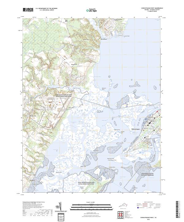
2022 Map of Chincoteague West
USGS Topo · Published 2022About this map
Chincoteague Island and the intricate tidal waters of Chincoteague Bay define this coastal landscape, where the town of Chincoteague sits at the heart of a complex network of channels and marshes. The island itself is densely annotated with family and community history, evidenced by a cluster of sites including Greenwood Cem, Aydelotte Cem, and the Christ Union Baptist Church. These landmarks reveal the deep-rooted settlement patterns of the Eastern Shore's fishing and maritime communities.
Find a feature on this map
159 named features on this map. Tap any name to fly to it.
Don’t see what you’re looking for? This feature index may not catch every label — zoom into the map to look around manually.
Map Details
Editions of this 2022 Chincoteague West Map
This is the sole edition of this map. No revisions or reprints were ever made.
Other maps of this area

1901 · Snow Hill
USGS Topo · 1:62,500

1942 · Chincoteague East
USGS Topo · 1:24,000

1942 · Mappsville
USGS Topo · 1:24,000

1942 · Wallops Island
USGS Topo · 1:24,000

1943 · Boxiron
USGS Topo · 1:31,680

1943 · Mappsville
USGS Topo · 1:31,680

1943 · Chincoteague West
USGS Topo · 1:31,680
1943 · Girdletree
USGS Topo · 1:31,680
1943 · Hallwood
USGS Topo · 1:31,680
1943 · Pocomoke City
USGS Topo · 1:31,680