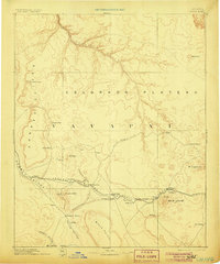
1891 Map of Chino
USGS Topo · Published 1906About this map
The Atlantic and Pacific Railroad cuts a critical path across this high desert landscape, tracing a route through the Aubrey Valley and into the timbered country of the Black Forest. This 1891 reconnaissance map illustrates a pivotal era of westward expansion, where the railroad and the earlier Beale Wagon road provided the primary arteries for settlement in Yavapai and Coconino. The topography transitions from the dramatic Aubrey Cliffs to the prominent heights of Bill Williams Mt 9264.
Find a feature on this map
36 named features on this map. Tap any name to fly to it.
Don’t see what you’re looking for? This feature index may not catch every label — zoom into the map to look around manually.
Map Details
Editions of this 1891 Chino Map
4 editions found
Other maps of this area

1886 · Diamond Creek
USGS Topo · 1:250,000

1886 · San Francisco Mtns
USGS Topo · 1:250,000

1886 · Mt. Trumbull
USGS Topo · 1:250,000

1886 · Chino
USGS Topo · 1:250,000

1886 · Echo Cliffs
USGS Topo · 1:250,000

1886 · Kaibab
USGS Topo · 1:250,000

1887 · Verde
USGS Topo · 1:250,000

1887 · Prescott
USGS Topo · 1:250,000

1891 · San Francisco Mtns
USGS Topo · 1:250,000

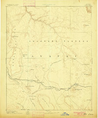
1891 · Chino
USGS Topo · 1:250,000