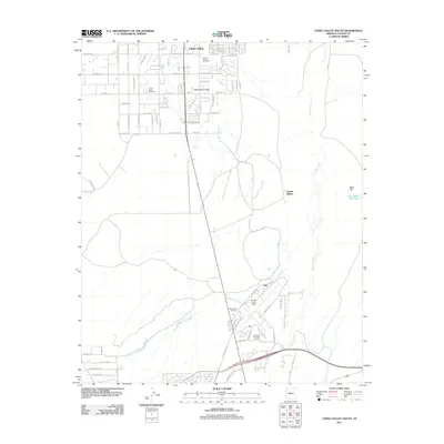
2011 Map of Chino Valley South
USGS Topo · Published 2011About this map
Chino Valley and the smaller Little Chino Valley define this landscape just north of Prescott in the early twenty-first century. The map documents an area where residential development meets aviation and rail history, anchored by the presence of Ernest A Love Field and the private Robin Stolport. This period shows a distinctive grid of rural roads, such as Reyes Rd and W Road 1 S, cutting across the natural drainages of Bottleneck Wash and Granite Creek.
Find a feature on this map
72 named features on this map. Tap any name to fly to it.
Don’t see what you’re looking for? This feature index may not catch every label — zoom into the map to look around manually.
Map Details
Editions of this 2011 Chino Valley South Map
This is the sole edition of this map. No revisions or reprints were ever made.
Other maps of this area

1887 · Prescott
USGS Topo · 1:250,000

1892 · Prescott
USGS Topo · 1:250,000

1905 · Jerome
USGS Topo · 1:125,000

1947 · Simmons
USGS Topo · 1:62,500

1947 · Iron Springs
USGS Topo · 1:62,500

1947 · Paulden
USGS Topo · 1:62,500

1947 · Prescott
USGS Topo · 1:62,500

1948 · Iron Springs
USGS Topo · 1:63,360

1948 · Prescott
USGS Topo · 1:62,500

1948 · Simmons
USGS Topo · 1:63,360