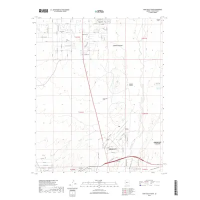
2018 Map of Chino Valley South
USGS Topo · Published 2018About this map
Chino Valley and the northern outskirts of Prescott dominate this 2018 survey, reflecting the rapid growth and water management of central Arizona. The landscape is defined by the transition from the high desert plains of Lonesome Valley to the more structured infrastructure serving the urban centers. Transportation and aviation are central to this area's identity, anchored by Ernest A Love Field and the smaller Robin Airport, while the legacy of the railroad is preserved at Granite Siding.
Find a feature on this map
90 named features on this map. Tap any name to fly to it.
Don’t see what you’re looking for? This feature index may not catch every label — zoom into the map to look around manually.
Map Details
Editions of this 2018 Chino Valley South Map
This is the sole edition of this map. No revisions or reprints were ever made.
Other maps of this area

1887 · Prescott
USGS Topo · 1:250,000

1892 · Prescott
USGS Topo · 1:250,000

1905 · Jerome
USGS Topo · 1:125,000

1947 · Simmons
USGS Topo · 1:62,500

1947 · Iron Springs
USGS Topo · 1:62,500

1947 · Paulden
USGS Topo · 1:62,500

1947 · Prescott
USGS Topo · 1:62,500

1948 · Iron Springs
USGS Topo · 1:63,360

1948 · Prescott
USGS Topo · 1:62,500

1948 · Simmons
USGS Topo · 1:63,360