
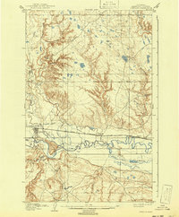
1904 Map of Chinook
USGS Topo · Published 1904About this map
Chinook serves as the focal point of this 1902 survey, situated along the Great Northern railroad in a landscape defined by both industrial and agricultural expansion. The map documents an early twentieth-century Montana valley where complex water management systems, such as the Ft. Belknap Ditch, Matheson Ditch, and the Irrigation Co. Canal, were already being established to redirect the waters of the Milk River.
Find a feature on this map
34 named features on this map. Tap any name to fly to it.
Don’t see what you’re looking for? This feature index may not catch every label — zoom into the map to look around manually.
Map Details
Editions of this 1904 Chinook Map
2 editions found
Other maps of this area

1904 · Yantic
USGS Topo · 1:62,500

1905 · Harlem
USGS Topo · 1:62,500

1912 · Zurich
USGS Topo · 1:125,000

1913 · Cherry Ridge
USGS Topo · 1:125,000

1953 · Havre
USGS Topo · 1:250,000

1956 · Lloyd
USGS Topo · 1:62,500

1956 · Cleveland
USGS Topo · 1:62,500

1957 · Havre
USGS Topo · 1:250,000

1958 · Havre
USGS Topo · 1:250,000
1964 · Big Coulee
USGS Topo · 1:24,000