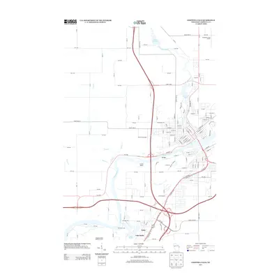
2013 Map of Chippewa Falls
USGS Topo · Published 2013About this map
The Chippewa River serves as the central artery for this region of Wisconsin, where the settlement of Irvine and the waters of Lake Hallie define the residential and recreational landscape. The topography is shaped by a complex system of tributaries and impoundments, including Duncan Cr, Glen Lock Lake, and the Tilden Millpond. This map reflects a landscape deeply integrated with aviation and modern transport, featuring three distinct landing facilities: Chippewa Valley Regional Airport, Rosenbaum Field Airport, and Blunt Field Airport.
Find a feature on this map
78 named features on this map. Tap any name to fly to it.
Don’t see what you’re looking for? This feature index may not catch every label — zoom into the map to look around manually.
Map Details
Editions of this 2013 Chippewa Falls Map
This is the sole edition of this map. No revisions or reprints were ever made.
Other maps of this area

1934 · Elk Mound
USGS Topo · 1:62,500

1934 · Chippewa Falls
USGS Topo · 1:62,500

1936 · Chippewa Falls
USGS Topo · 1:62,500

1936 · Elk Mound
USGS Topo · 1:62,500

1949 · Bloomer
USGS Topo · 1:62,500

1949 · New Auburn
USGS Topo · 1:62,500

1951 · Bloomer
USGS Topo · 1:62,500

1951 · New Auburn
USGS Topo · 1:62,500

1953 · Eau Claire
USGS Topo · 1:250,000

1953 · Rice Lake
USGS Topo · 1:250,000