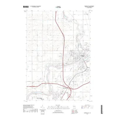
2018 Map of Chippewa Falls
USGS Topo · Published 2018About this map
The Chippewa River serves as the central artery for this region of Wisconsin, defining the landscape between Chippewa Falls and northern Eau Claire. The map illustrates a transition from the urban grid of Chippewa Falls, centered near the confluence of Duncan Creek and the river, to the newer developments and transport hubs in Lake Hallie. The presence of several historic burial grounds, such as Forest Hill Cem, Hope Cem, and Calvary Cem, provides a detailed record for genealogists and local historians. North of the city, Tilden Millpond and the rural roads like 90th Ave show the area's agricultural character. Key infrastructure is well represented, including the Chippewa Valley Regional Airport in the south and industrial sites like Gravel Island, which speak to the area's ongoing economic development and its historical ties to the river.
Find a feature on this map
101 named features on this map. Tap any name to fly to it.
Don’t see what you’re looking for? This feature index may not catch every label — zoom into the map to look around manually.
Map Details
Editions of this 2018 Chippewa Falls Map
This is the sole edition of this map. No revisions or reprints were ever made.
Other maps of this area

1934 · Elk Mound
USGS Topo · 1:62,500

1934 · Chippewa Falls
USGS Topo · 1:62,500

1936 · Chippewa Falls
USGS Topo · 1:62,500

1936 · Elk Mound
USGS Topo · 1:62,500

1949 · Bloomer
USGS Topo · 1:62,500

1949 · New Auburn
USGS Topo · 1:62,500

1951 · Bloomer
USGS Topo · 1:62,500

1951 · New Auburn
USGS Topo · 1:62,500

1953 · Eau Claire
USGS Topo · 1:250,000

1953 · Rice Lake
USGS Topo · 1:250,000