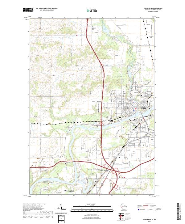
2022 Map of Chippewa Falls
USGS Topo · Published 2022About this map
The Chippewa River flows through the heart of this region, shaping the development of Chippewa Falls and Lake Hallie. This 2022 survey documents a landscape defined by the convergence of urban infrastructure and significant water bodies, including Star Lake and the northern Tilden Millpond. Cultural and civic landmarks are well-represented, from the Chippewa County Courthouse in the city center to the sprawling grounds of the Chippewa Valley Regional Airport in Eau Claire at the southern margin. Genealogists will find considerable value in the numerous burial sites identified across the quadrangle, such as Forest Hill Cem, Calvary Cem, and the more isolated Rumery Cem. The map provides a clear picture of modern land use, showing how residential growth around Hallie has filled the space between the larger municipal hubs.
Find a feature on this map
185 named features on this map. Tap any name to fly to it.
Don’t see what you’re looking for? This feature index may not catch every label — zoom into the map to look around manually.
Map Details
Editions of this 2022 Chippewa Falls Map
This is the sole edition of this map. No revisions or reprints were ever made.
Other maps of this area

1934 · Elk Mound
USGS Topo · 1:62,500

1934 · Chippewa Falls
USGS Topo · 1:62,500

1936 · Chippewa Falls
USGS Topo · 1:62,500

1936 · Elk Mound
USGS Topo · 1:62,500

1949 · Bloomer
USGS Topo · 1:62,500

1949 · New Auburn
USGS Topo · 1:62,500

1951 · Bloomer
USGS Topo · 1:62,500

1951 · New Auburn
USGS Topo · 1:62,500

1953 · Eau Claire
USGS Topo · 1:250,000

1953 · Rice Lake
USGS Topo · 1:250,000