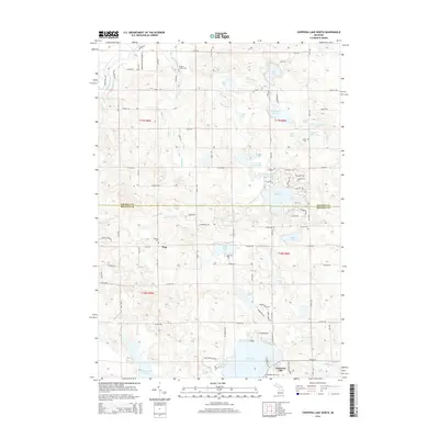
2014 Map of Chippewa Lake North
USGS Topo · Published 2014About this map
Chippewa Lake anchors the southern landscape of this 2014 survey, which covers the transition from the lakefront community to the rural interiors of Osceola and Mecosta Counties. The terrain is defined by a dense network of glacial lakes and small tributaries, including the Muskegon River winding through the northwest corner. Genealogists will find several burial grounds across the area, from the Proctor Family Cem near Big Stone Cr to the Pioneer Cem located near the settlement of Pogy. The map reveals the intricate residential and recreational development surrounding Lake Miramichi, where a series of themed roads like Chippewa Trl and Pontiac Trl circle the water. Further south, the Haymarsh Lakes and Haymarsh Cr provide a contrast of more open, marshy wetlands. This modern record details how early rural settlements and cemeteries have been preserved alongside the growing shoreline communities.
Find a feature on this map
64 named features on this map. Tap any name to fly to it.
Don’t see what you’re looking for? This feature index may not catch every label — zoom into the map to look around manually.
Map Details
Editions of this 2014 Chippewa Lake North Map
This is the sole edition of this map. No revisions or reprints were ever made.
Other maps of this area

1954 · Midland
USGS Topo · 1:250,000

1958 · Midland
USGS Topo · 1:250,000

1958 · Big Rapids
USGS Topo · 1:62,500

1959 · Midland
USGS Topo · 1:250,000

1959 · Lake
USGS Topo · 1:62,500

1959 · Evart
USGS Topo · 1:62,500

1964 · Mecosta NW
USGS Topo · 1:24,000

1966 · Midland
USGS Topo · 1:250,000

1976 · Evart SW
USGS Topo · 1:24,000
1976 · Big Rapids NW
USGS Topo · 1:24,000