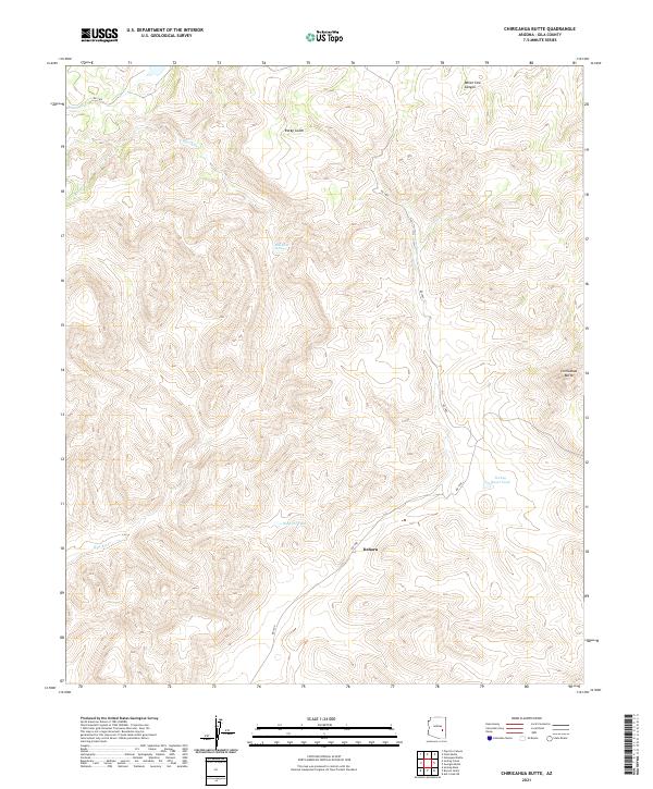
2021 Map of Chiricahua Butte
USGS Topo · Published 2021About this map
Dehorn stands as a focal point in this 2021 topographic survey of Arizona's high desert landscape, situated near the intersection of RD 1500 and RD 1400. The terrain is defined by the sharp rise of Chiricahua Butte and the drainage network formed by the Blue River, which flows through the western half of the quadrangle. Local hydrology is further marked by the Blue River Spring and several remote water catchments, including Hospital Tank and Turkey Roost Tank. The landscape is carved by prominent geological features such as Rocky Gulch and White Cow Canyon, reflecting a rugged environment typical of Gila County. The map provides a precise look at the township and range system, specifically noting the divisions of t3n r20e, t3n r21e, t2n r20e, and t2n r21e, which are essential for property and boundary research in this part of the state.
Find a feature on this map
14 named features on this map. Tap any name to fly to it.
Don’t see what you’re looking for? This feature index may not catch every label — zoom into the map to look around manually.
Map Details
Editions of this 2021 Chiricahua Butte Map
This is the sole edition of this map. No revisions or reprints were ever made.
Other maps of this area

1954 · Mesa
USGS Topo · 1:250,000

1957 · Mesa
USGS Topo · 1:250,000

1958 · Mesa
USGS Topo · 1:250,000

1960 · Mesa
USGS Topo · 1:250,000

1964 · Mesa
USGS Topo · 1:250,000

1965 · Sontag Mesa
USGS Topo · 1:24,000
1966 · Bronco Gulch
USGS Topo · 1:24,000

1966 · Georges Butte
USGS Topo · 1:24,000
1966 · Ash Creek NE
USGS Topo · 1:24,000

1966 · Popcorn Canyon
USGS Topo · 1:24,000