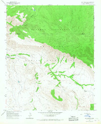
1966 Map of Ash Creek NE
USGS Topo · Published 1967About this map
The Natanes Plateau dominates the northern landscape of this 1966 survey, where the high mesa drops sharply into the rugged canyons of the San Carlos Indian Reservation. This terrain is defined by its drainage systems, most notably Ash Creek and the curiously named Sweetmeat Draw, which carve deep into the plateau's southern face. The map reveals a land utilized primarily for ranching and resource management, evidenced by numerous water catchments like Armstrong Tank, Deadman Tank, and Kidde Tank. A remote outpost marked as Wild Monkey Trap sits on the plateau's edge, highlighting the localized nomenclature of the Arizona backcountry. Navigability is limited to a primitive Jeep Trail that winds along the creek beds, following the natural contours of Kidde Canyon toward the Gila and Graham County line.
Find a feature on this map
15 named features on this map. Tap any name to fly to it.
Don’t see what you’re looking for? This feature index may not catch every label — zoom into the map to look around manually.
Map Details
Editions of this 1966 Ash Creek NE Map
This is the sole edition of this map. No revisions or reprints were ever made.
Other maps of this area

1954 · Clifton
USGS Topo · 1:250,000

1954 · Mesa
USGS Topo · 1:250,000

1957 · Mesa
USGS Topo · 1:250,000

1957 · Clifton
USGS Topo · 1:250,000

1958 · Clifton
USGS Topo · 1:250,000

1958 · Mesa
USGS Topo · 1:250,000

1960 · Mesa
USGS Topo · 1:250,000

1962 · Clifton
USGS Topo · 1:250,000

1964 · Mesa
USGS Topo · 1:250,000

1966 · Branaman Spring
USGS Topo · 1:24,000