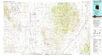
1994 Map of Chiricahua Peak
USGS Topo · Published 1994About this map
The Chiricahua Mountains dominate the eastern landscape of this Cochise County survey, their high ridges sheltered within the Chiricahua Wilderness and Coronado National Forest. This region shows a transition from the elevated peaks of the Chiricahua National Monument to the broad drainage basins of the Sulphur Springs Valley and the San Simon Valley. Settlement is concentrated along transport corridors like Highway 191 and the Southern Pacific railroad line, connecting small communities such as Sunsites, Pearce, and Elfrida.
Find a feature on this map
45 named features on this map. Tap any name to fly to it.
Don’t see what you’re looking for? This feature index may not catch every label — zoom into the map to look around manually.
Map Details
Editions of this 1994 Chiricahua Peak Map
2 editions found
Other maps of this area

1902 · Bisbee
USGS Topo · 1:62,500

1910 · Bisbee
USGS Topo · 1:62,500

1914 · Hereford
USGS Topo · 1:125,000

1914 · Douglas
USGS Topo · 1:62,500

1915 · Benson
USGS Topo · 1:125,000

1916 · Pearce
USGS Topo · 1:125,000

1916 · Douglas
USGS Topo · 1:125,000

1917 · San Simon
USGS Topo · 1:125,000

1917 · Chiricahua
USGS Topo · 1:125,000

1918 · Cienega Springs
USGS Topo · 1:62,500