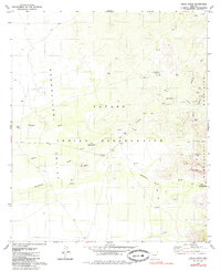
1979 Map of Chiuli Shaik
USGS Topo · Published 1985About this map
The Papago Indian Reservation landscape is defined by the high desert plains of the Baboquivari Valley and the sharp rise of the Baboquivari Mountains. This 1970s survey captures several traditional O'odham settlements, including Chiuli Shaik, Topawa, and Pitoikam, along with the historical Kohi Kug (Site). The map records the essential water-dependent infrastructure of the era, from numerous named wells to the seasonal flow of Fresnal Wash and Baboquivari Wash. In the higher elevations to the east, landmarks like Natural Arch and Montezuma Cave stand near Gu Kui-Chuchg (Baboquivari Camp). Resource extraction and survival in this arid environment are evident through labels for the Allison Mine and various prospects, connected by a network of unimproved roads and a Jeep Trail.
Find a feature on this map
23 named features on this map. Tap any name to fly to it.
Don’t see what you’re looking for? This feature index may not catch every label — zoom into the map to look around manually.
Map Details
Editions of this 1979 Chiuli Shaik Map
2 editions found
Other maps of this area

1941 · Presumido Peak
USGS Topo · 1:62,500

1941 · Baboquivari Peak
USGS Topo · 1:62,500

1941 · Vamori
USGS Topo · 1:62,500

1941 · Sells
USGS Topo · 1:62,500

1943 · Sells
USGS Topo · 1:62,500

1943 · Fresnal
USGS Topo · 1:125,000

1943 · Presumido Peak
USGS Topo · 1:62,500

1943 · Vamori
USGS Topo · 1:62,500

1944 · Baboquivari Peak
USGS Topo · 1:62,500

1956 · Nogales
USGS Topo · 1:250,000