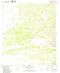
1979 Map of Chiuli Shaik
USGS Topo · Published 1979About this map
Papago Indian Reservation land defines this desert landscape, where the Baboquivari Mountains rise sharply above the Baboquivari Valley. The map documents several small settlements and traditional sites, including Chiuli Shaik, Pitoikam, and the Kohi Kug (Site). Water management is central to life here, evidenced by numerous labels for wells, water tanks, and dams scattered along the drainages of Fresnal Wash and Baboquivari Wash.
Find a feature on this map
26 named features on this map. Tap any name to fly to it.
Don’t see what you’re looking for? This feature index may not catch every label — zoom into the map to look around manually.
Map Details
Editions of this 1979 Chiuli Shaik Map
2 editions found
Other maps of this area

1941 · Presumido Peak
USGS Topo · 1:62,500

1941 · Baboquivari Peak
USGS Topo · 1:62,500

1941 · Vamori
USGS Topo · 1:62,500

1941 · Sells
USGS Topo · 1:62,500

1943 · Sells
USGS Topo · 1:62,500

1943 · Fresnal
USGS Topo · 1:125,000

1943 · Presumido Peak
USGS Topo · 1:62,500

1943 · Vamori
USGS Topo · 1:62,500

1944 · Baboquivari Peak
USGS Topo · 1:62,500

1956 · Nogales
USGS Topo · 1:250,000