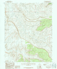
1987 Map of Chocolate Drop
USGS Topo · Published 1987About this map
Chocolate Drop rises above a high-desert landscape defined by deep drainage systems and mineral prospecting in the late twentieth century. This 1980s provisional survey of San Juan County captures the region as it was undergoing geological evaluation, specifically highlighting a Uranium deposit situated between Red Canyon and Blue Canyon. The topography is dominated by massive flat-topped features such as Wingate Mesa and Mangos Mesa, with the land carved out by the North Fork and South Fork tributaries.
Find a feature on this map
13 named features on this map. Tap any name to fly to it.
Don’t see what you’re looking for? This feature index may not catch every label — zoom into the map to look around manually.
Map Details
Editions of this 1987 Chocolate Drop Map
This is the sole edition of this map. No revisions or reprints were ever made.
Other maps of this area

1886 · Henry Mountains
USGS Topo · 1:250,000

1892 · Henry Mountains
USGS Topo · 1:250,000

1952 · Mancos Mesa
USGS Topo · 1:62,500

1952 · Natural Bridges
USGS Topo · 1:62,500

1954 · White Canyon 3 SE
USGS Topo · 1:24,000

1954 · White Canyon 3 NW
USGS Topo · 1:24,000

1954 · White Canyon 3 NE
USGS Topo · 1:24,000

1954 · White Canyon 4 SW
USGS Topo · 1:24,000
1954 · White Canyon 4 NW
USGS Topo · 1:24,000

1954 · White Canyon 3 SW
USGS Topo · 1:24,000