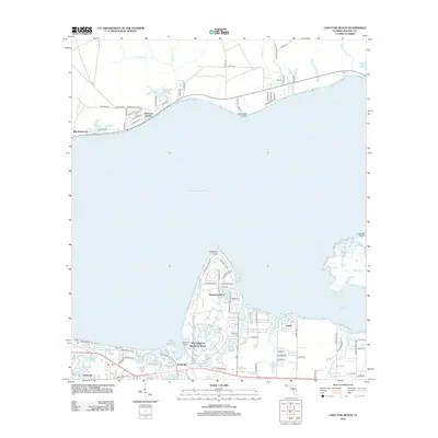
2012 Map of Choctaw Beach
USGS Topo · Published 2012About this map
Choctawhatchee Bay separates the northern and southern halves of this coastal landscape, creating a distinct split between the residential communities on the northern shore and the developed resort areas to the south. Along the northern shoreline, Choctaw Beach and Big Hammock follow the curve of the water, punctuated by drainage from Mullet Cr and Piney Cr. To the south, the map documents the sophisticated layout of The Village of Baytowne Wharf and the surrounding Sandestin area.
Find a feature on this map
88 named features on this map. Tap any name to fly to it.
Don’t see what you’re looking for? This feature index may not catch every label — zoom into the map to look around manually.
Map Details
Editions of this 2012 Choctaw Beach Map
This is the sole edition of this map. No revisions or reprints were ever made.
Other maps of this area

1934 · Niceville
USGS Topo · 1:48,000

1935 · Villa Tasso
USGS Topo · 1:48,000

1935 · De Funiak Springs
USGS Topo · 1:48,000

1936 · Niceville
USGS Topo · 1:62,500

1936 · Point Washington
USGS Topo · 1:48,000

1938 · Villa Tasso
USGS Topo · 1:62,500

1938 · De Funiak Springs
USGS Topo · 1:62,500

1939 · Point Washington
USGS Topo · 1:62,500

1956 · Niceville
USGS Topo · 1:62,500

1956 · Villa Tasso
USGS Topo · 1:62,500