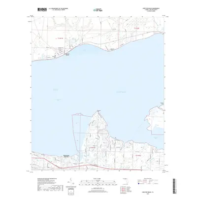
2018 Map of Choctaw Beach
USGS Topo · Published 2018About this map
Choctawhatchee Bay and the Gulf of Mexico define this coastal landscape in Walton County, split by the Intracoastal Waterway. The northern shore is anchored by the community of Choctaw Beach, where a grid of residential streets like Sycamore Dr and Persimmon St meets the water at Big Hammock Point. This area is characterized by small tributaries and ponds, including Sharon Lake and Foster Burgess Pond, which drain into Grassy Cove.
Find a feature on this map
82 named features on this map. Tap any name to fly to it.
Don’t see what you’re looking for? This feature index may not catch every label — zoom into the map to look around manually.
Map Details
Editions of this 2018 Choctaw Beach Map
This is the sole edition of this map. No revisions or reprints were ever made.
Other maps of this area

1934 · Niceville
USGS Topo · 1:48,000

1935 · Villa Tasso
USGS Topo · 1:48,000

1935 · De Funiak Springs
USGS Topo · 1:48,000

1936 · Niceville
USGS Topo · 1:62,500

1936 · Point Washington
USGS Topo · 1:48,000

1938 · Villa Tasso
USGS Topo · 1:62,500

1938 · De Funiak Springs
USGS Topo · 1:62,500

1939 · Point Washington
USGS Topo · 1:62,500

1956 · Niceville
USGS Topo · 1:62,500

1956 · Villa Tasso
USGS Topo · 1:62,500