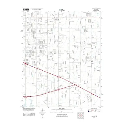
2012 Map of Choctaw
USGS Topo · Published 2012About this map
Nicoma Park serves as a primary residential center on this 2012 survey of the Oklahoma City metropolitan fringe, exhibiting a dense network of suburban streets and established neighborhoods. The landscape is defined by the gentle drainage of Choctaw Cr, which threads through the northern sections of the quadrangle. Local history and genealogy are anchored by the presence of New Hope Church Cem, located south of the main settlement areas. This map documents a period of significant growth and residential expansion in the early 21st century, showing the transition from traditional rural land use to a modern suburban community structure.
Find a feature on this map
3 named features on this map. Tap any name to fly to it.
Don’t see what you’re looking for? This feature index may not catch every label — zoom into the map to look around manually.
Map Details
Editions of this 2012 Choctaw Map
This is the sole edition of this map. No revisions or reprints were ever made.
Other maps of this area

1892 · Moore
USGS Topo · 1:62,500

1892 · Edmond
USGS Topo · 1:62,500

1898 · Purcell
USGS Topo · 1:125,000

1909 · Luther
USGS Topo · 1:62,500

1930 · McLoud
USGS Topo · 1:62,500

1934 · Crutcho Creek
USGS Topo · 1:24,000

1934 · Moore
USGS Topo · 1:62,500

1935 · Spencer
USGS Topo · 1:24,000

1935 · Edmond
USGS Topo · 1:48,000

1938 · Moore
USGS Topo · 1:62,500