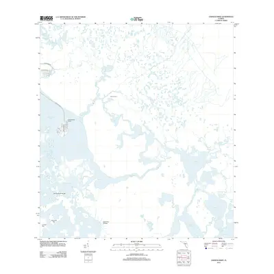
2012 Map of Chokoloskee
USGS Topo · Published 2012About this map
Chokoloskee Island serves as the primary hub of habitation in this intricate aquatic landscape, situated at the edge of the Chokoloskee Bay. The area is defined by a dense labyrinth of mangrove keys and tidal waterways within the Ten Thousand Islands region, where the Turner River and Lopez River flow toward the Gulf of Mexico. The map illustrates a complex network of named passes and bays, such as Rabbit Key Pass and Sunday Bay, which have long dictated movement through these coastal wetlands. On the island itself, local geography is detailed via street names like Smallwood Dr and Copeland Ave, reflecting the modern infrastructure established upon this unique shell mound. Further inland, the presence of distinctively named terrain such as Hells Half Acre and Rabbit Key Grasses highlights the specific ecological character of this subtropical wilderness.
Find a feature on this map
28 named features on this map. Tap any name to fly to it.
Don’t see what you’re looking for? This feature index may not catch every label — zoom into the map to look around manually.
Map Details
Editions of this 2012 Chokoloskee Map
This is the sole edition of this map. No revisions or reprints were ever made.
Other maps of this area

1956 · Miami
USGS Topo · 1:250,000

1958 · Miami
USGS Topo · 1:250,000

1972 · Weavers Station
USGS Topo · 1:24,000

1972 · Burns Lake
USGS Topo · 1:24,000

1972 · Ochopee
USGS Topo · 1:24,000

1973 · Gator Hook Swamp
USGS Topo · 1:24,000

1973 · Pavilion Key
USGS Topo · 1:24,000

1973 · Alligator Bay
USGS Topo · 1:24,000
1974 · Everglades City
USGS Topo · 1:24,000
1974 · Chokoloskee
USGS Topo · 1:24,000