
1972 Map of Ochopee
USGS Topo · Published 1976About this map
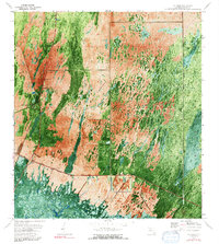
Ochopee and the surrounding cypress strands of Collier County are documented in this orthophotomap, which blends aerial photography with traditional topographic data. The landscape is defined by the heavy vegetation of the Fakahatchee Strand and the open stretches of Copeland Prairie. Human activity is focused along the Tamiami Trail, where the small communities of Carnestown and Ochopee sit near the southern edge of the survey.
Find a feature on this map
15 named features on this map. Tap any name to fly to it.
Don’t see what you’re looking for? This feature index may not catch every label — zoom into the map to look around manually.
Map Details
Editions of this 1972 Ochopee Map
2 editions found
Other maps of this area

1956 · Miami
USGS Topo · 1:250,000

1956 · West Palm Beach
USGS Topo · 1:250,000

1957 · West Palm Beach
USGS Topo · 1:250,000

1958 · West Palm Beach
USGS Topo · 1:250,000

1958 · Miami
USGS Topo · 1:250,000

1959 · Deep Lake
USGS Topo · 1:24,000

1959 · Deep Lake SW
USGS Topo · 1:24,000

1972 · Weavers Station
USGS Topo · 1:24,000

1972 · Burns Lake
USGS Topo · 1:24,000

1973 · Gator Hook Swamp
USGS Topo · 1:24,000