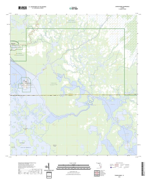
2025 Map of Chokoloskee
USGS Topo · Published 2025About this map
Chokoloskee Island serves as a primary hub of human activity within this coastal Florida landscape, where the transition between the Gulf and the interior wetlands is defined by the labyrinthine Ten Thousand Islands. The map details a complex hydrologic network including the Turner River, Lopez River, and Huston Bay, which form the backbone of the region's aquatic navigation. Local history and genealogy interests are anchored by the settlement of Chokoloskee and a Possible U / I Cem noted near the island's western shore.
Find a feature on this map
38 named features on this map. Tap any name to fly to it.
Don’t see what you’re looking for? This feature index may not catch every label — zoom into the map to look around manually.
Map Details
Editions of this 2025 Chokoloskee Map
This is the sole edition of this map. No revisions or reprints were ever made.
Other maps of this area

1956 · Miami
USGS Topo · 1:250,000

1958 · Miami
USGS Topo · 1:250,000

1972 · Weavers Station
USGS Topo · 1:24,000

1972 · Burns Lake
USGS Topo · 1:24,000

1972 · Ochopee
USGS Topo · 1:24,000

1973 · Gator Hook Swamp
USGS Topo · 1:24,000

1973 · Pavilion Key
USGS Topo · 1:24,000

1973 · Alligator Bay
USGS Topo · 1:24,000
1974 · Everglades City
USGS Topo · 1:24,000
1974 · Chokoloskee
USGS Topo · 1:24,000