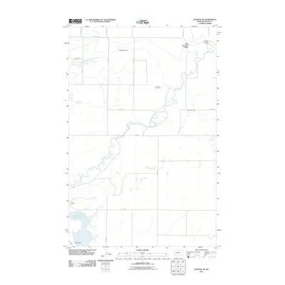
2011 Map of Choteau SE
USGS Topo · Published 2011About this map
The Teton River meanders across this high plains landscape in Teton County, defining the agricultural and water management patterns of the region. In the northeast, the New Rockport Colony stands as a focal point of communal settlement, situated near the winding riverbanks and the drainage of Spring Coulee. The terrain is characterized by several geographic depressions including Gamble Coulee and Coyote Coulee, which channel seasonal runoff toward the primary river system. To the southwest, the prominent elevation of Priest Butte overlooks the waters of Priest Butte Lake. Human intervention in the landscape is evident through the Ferris Farms Dam and a geometric grid of rural roads such as 18th Rd NW and Rte-221. The presence of Hobson Spur indicates the area's historical reliance on transportation infrastructure to move agricultural goods from these remote northern Montana fields.
Find a feature on this map
20 named features on this map. Tap any name to fly to it.
Don’t see what you’re looking for? This feature index may not catch every label — zoom into the map to look around manually.
Map Details
Editions of this 2011 Choteau SE Map
This is the sole edition of this map. No revisions or reprints were ever made.
Other maps of this area

1886 · Great Falls
USGS Topo · 1:250,000

1920 · Choteau
USGS Topo · 1:125,000

1950 · Fairfield
USGS Topo · 1:62,500

1950 · Collins
USGS Topo · 1:62,500

1954 · Great Falls
USGS Topo · 1:250,000

1955 · Choteau
USGS Topo · 1:250,000

1957 · Choteau
USGS Topo · 1:250,000

1957 · Great Falls
USGS Topo · 1:250,000

1958 · Choteau
USGS Topo · 1:250,000

1960 · Choteau
USGS Topo · 1:62,500