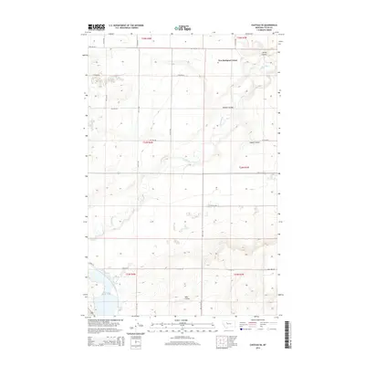
2014 Map of Choteau SE
USGS Topo · Published 2014About this map
New Rockport Colony sits at the northern edge of this Teton County landscape, where the agricultural community is defined by the winding course of the Teton River. This 2014 survey reveals a transition from the elevated Bole Bench in the southeast down into a series of drainage features including Spring Coulee, Gamble Coulee, and Coyote Coulee. The section lines and gravel roads like 18th Rd NW and 11th Rd NW impose a strict grid over the naturally irregular terrain. In the southwest corner, the Priest Butte Lakes provide a significant hydrological landmark, while Wolf Coulee carves through the southern sections. The map serves as a contemporary record of Hutterite settlement patterns and the persistence of traditional land divisions in this part of Montana.
Find a feature on this map
26 named features on this map. Tap any name to fly to it.
Don’t see what you’re looking for? This feature index may not catch every label — zoom into the map to look around manually.
Map Details
Editions of this 2014 Choteau SE Map
This is the sole edition of this map. No revisions or reprints were ever made.
Other maps of this area

1886 · Great Falls
USGS Topo · 1:250,000

1920 · Choteau
USGS Topo · 1:125,000

1950 · Fairfield
USGS Topo · 1:62,500

1950 · Collins
USGS Topo · 1:62,500

1954 · Great Falls
USGS Topo · 1:250,000

1955 · Choteau
USGS Topo · 1:250,000

1957 · Choteau
USGS Topo · 1:250,000

1957 · Great Falls
USGS Topo · 1:250,000

1958 · Choteau
USGS Topo · 1:250,000

1960 · Choteau
USGS Topo · 1:62,500