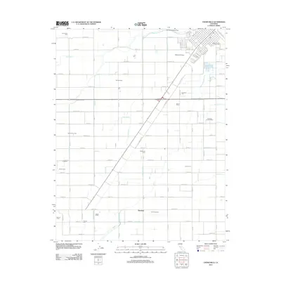
2012 Map of Chowchilla
USGS Topo · Published 2012About this map
Madera County's agricultural landscape is defined by an intricate network of irrigation and dairy production in this 2012 survey. The area around Dairyland is segmented by essential water infrastructure, including the Ash Slough Bypass Canal, Robertson Lateral, and the Califa Canal, which support a dense concentration of named family operations. From the Faust Family Dairy in the northwest to the Avila Family Dairy and Triangle M Dairy in the south, these labels provide a specific record of land use and ownership. The town site itself is anchored by the Madera County Fairgrounds and the Po, while the surrounding rural blocks contain family landmarks like Wolfshorndl Farms and the Bench G Ranch. The alignment of Railroad Ave and Railroad Dr underscores the historical importance of rail transport in moving the region's agricultural output to market.
Find a feature on this map
81 named features on this map. Tap any name to fly to it.
Don’t see what you’re looking for? This feature index may not catch every label — zoom into the map to look around manually.
Map Details
Editions of this 2012 Chowchilla Map
This is the sole edition of this map. No revisions or reprints were ever made.
Other maps of this area

1916 · Berenda
USGS Topo · 1:31,680

1918 · Bliss Ranch
USGS Topo · 1:31,680

1918 · Lingard
USGS Topo · 1:31,680

1918 · Chowchilla
USGS Topo · 1:31,680

1918 · Berenda
USGS Topo · 1:31,680

1918 · La Grand
USGS Topo · 1:31,680

1919 · Plainsberg
USGS Topo · 1:31,680

1920 · Bonita Ranch
USGS Topo · 1:31,680

1921 · Bonita Ranch
USGS Topo · 1:31,680

1922 · Pozo Farm
USGS Topo · 1:31,680