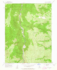
1954 Map of Chris Flat
USGS Topo · Published 1963About this map
West Walker River carves a deep path through the canyon lands of the Toiyabe National Forest in this mid-century survey of Mono County. The landscape is defined by its small, level flats which provided critical footing for early development and recreation along the river corridor. Small settlements and specialized camps such as China Garden, Shingle Mill Flat, and Tollhouse Flat mark the transit through these steep valleys.
Find a feature on this map
30 named features on this map. Tap any name to fly to it.
Don’t see what you’re looking for? This feature index may not catch every label — zoom into the map to look around manually.
Map Details
Editions of this 1954 Chris Flat Map
5 editions found

Other maps of this area

1889 · Markleeville
USGS Topo · 1:125,000

1891 · Markleeville
USGS Topo · 1:125,000

1891 · Wellington
USGS Topo · 1:125,000

1893 · Markleeville
USGS Topo · 1:125,000

1893 · Wellington
USGS Topo · 1:125,000

1896 · Dardanelles
USGS Topo · 1:125,000

1898 · Dardanelles
USGS Topo · 1:125,000

1909 · Bridgeport
USGS Topo · 1:125,000

1911 · Bridgeport
USGS Topo · 1:125,000

1920 · Bridgeport
USGS Topo · 1:125,000