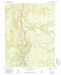
1954 Map of Chris Flat
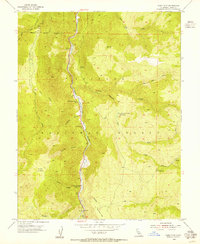
USGS Topo · Published 1986About this map
The West Walker River carves a central path through this mid-century survey of the Toiyabe National Forest, where high-elevation flats and canyons define the local geography. Human activity is concentrated along the river corridor, marked by a string of clearings including China Garden, Shingle Mill Flat, and Tollhouse Flat. These names suggest a legacy of timber harvesting and early transportation infrastructure in the Mono County backcountry.
Find a feature on this map
34 named features on this map. Tap any name to fly to it.
Don’t see what you’re looking for? This feature index may not catch every label — zoom into the map to look around manually.
Map Details
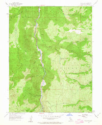
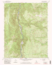
Editions of this 1954 Chris Flat Map
5 editions found

Other maps of this area

1889 · Markleeville
USGS Topo · 1:125,000

1891 · Markleeville
USGS Topo · 1:125,000

1891 · Wellington
USGS Topo · 1:125,000

1893 · Markleeville
USGS Topo · 1:125,000

1893 · Wellington
USGS Topo · 1:125,000

1896 · Dardanelles
USGS Topo · 1:125,000

1898 · Dardanelles
USGS Topo · 1:125,000

1909 · Bridgeport
USGS Topo · 1:125,000

1911 · Bridgeport
USGS Topo · 1:125,000

1920 · Bridgeport
USGS Topo · 1:125,000