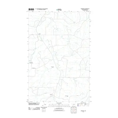
2011 Map of Christina
USGS Topo · Published 2011About this map
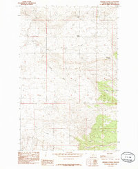
Christina and Suffolk serve as the primary focal points of this Fergus County landscape, where the prairie is deeply etched by a network of seasonal watercourses and drainage coulees. The terrain is defined by the wandering path of Dog Creek and Alkali Creek, which create a complex system of draws and breaks across the high plains. Local water management is evident through features like Erie Dam and the descriptively named Wicker Basket Number 1 Dam, essential for ranching in this arid environment. Significant topographic landmarks such as Sheepherder Peak and Murphy Coulee provide vertical relief and orientation in an area otherwise characterized by long, straight roadways like Washboard Rd and Andrews Rd. The map illustrates a contemporary rural Montana setting where the economy remains tied to the land and its limited water resources, from the Freeze Out Coulee to the headwaters of South Fork Cottonwood Creek.
Find a feature on this map
19 named features on this map. Tap any name to fly to it.
Don’t see what you’re looking for? This feature index may not catch every label — zoom into the map to look around manually.
Map Details
Editions of this 2011 Christina Map
This is the sole edition of this map. No revisions or reprints were ever made.
Other maps of this area

1954 · Lewistown
USGS Topo · 1:250,000

1959 · Lewistown
USGS Topo · 1:250,000

1978 · Lewistown
USGS Topo · 1:100,000

1985 · The Horse Ranch
USGS Topo · 1:24,000
1985 · Hilger NW
USGS Topo · 1:24,000
1985 · Kendall
USGS Topo · 1:24,000

1985 · Hilger
USGS Topo · 1:24,000
1985 · Christina
USGS Topo · 1:24,000

1985 · Armells
USGS Topo · 1:24,000
1985 · Gerhard Corner
USGS Topo · 1:24,000