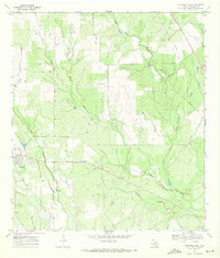
1969 Map of Christine East
USGS Topo · Published 1971About this map
La Parita Creek and its many tributaries, including Metate Creek and Turkey Creek, define the drainage patterns of this ranchland section in Atascosa County. The settlement of Christine sits on the western edge of the quadrangle, serving as a hub for the surrounding agricultural and ranching interests. This 1969 field-checked survey documents a landscape where the infrastructure of transportation and industry was actively shifting.
Find a feature on this map
15 named features on this map. Tap any name to fly to it.
Don’t see what you’re looking for? This feature index may not catch every label — zoom into the map to look around manually.
Map Details
Editions of this 1969 Christine East Map
2 editions found
Other maps of this area

1930 · Whitsett
USGS Topo · 1:62,500

1942 · Whitsett
USGS Topo · 1:62,500

1953 · Crystal City
USGS Topo · 1:250,000

1955 · Crystal City
USGS Topo · 1:250,000

1956 · Pleasanton
USGS Topo · 1:62,500

1956 · Jourdanton
USGS Topo · 1:62,500

1956 · Franklin Settlement
USGS Topo · 1:62,500

1961 · Crystal City
USGS Topo · 1:250,000
1965 · Caballos Creek
USGS Topo · 1:24,000
1965 · Whitsett
USGS Topo · 1:24,000