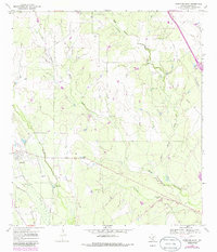
1969 Map of Christine East
USGS Topo · Published 1986About this map
Christine serves as the primary hub in this South Texas landscape, where the town's grid meets the branching paths of La Parita Creek and Turkey Creek. The 1969 field check captures a period of industrial presence and changing infrastructure, most notably the San Miguel Power Plant and an extensive Pipeline network cutting across the terrain. To the south, the Old Railroad Grade serves as a physical reminder of former transport corridors that once connected these rural communities.
Find a feature on this map
16 named features on this map. Tap any name to fly to it.
Don’t see what you’re looking for? This feature index may not catch every label — zoom into the map to look around manually.
Map Details
Editions of this 1969 Christine East Map
2 editions found
Other maps of this area

1930 · Whitsett
USGS Topo · 1:62,500

1942 · Whitsett
USGS Topo · 1:62,500

1953 · Crystal City
USGS Topo · 1:250,000

1955 · Crystal City
USGS Topo · 1:250,000

1956 · Pleasanton
USGS Topo · 1:62,500

1956 · Jourdanton
USGS Topo · 1:62,500

1956 · Franklin Settlement
USGS Topo · 1:62,500

1961 · Crystal City
USGS Topo · 1:250,000
1965 · Caballos Creek
USGS Topo · 1:24,000
1965 · Whitsett
USGS Topo · 1:24,000