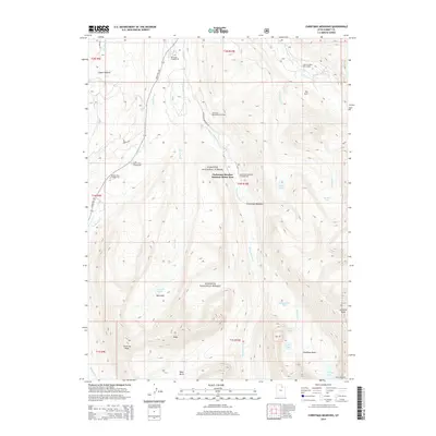
2014 Map of Christmas Meadows
USGS Topo · Published 2014About this map
The Christmas Meadow Summer Home Area is a focal point of seasonal activity within this high-elevation stretch of the Wasatch National Forest. The landscape is defined by the glacial carved basins and the headwaters of several major forks, including the Stillwater Fork, Hayden Fork, and Main Fork. The terrain transitions from riparian meadows near Christmas Meadows to prominent alpine summits such as Kletting Peak and Lamotte Peak.
Find a feature on this map
42 named features on this map. Tap any name to fly to it.
Don’t see what you’re looking for? This feature index may not catch every label — zoom into the map to look around manually.
Map Details
Editions of this 2014 Christmas Meadows Map
This is the sole edition of this map. No revisions or reprints were ever made.
Other maps of this area

1885 · Uinta
USGS Topo · 1:250,000

1901 · Hayden Peak
USGS Topo · 1:125,000

1903 · Hayden Peak
USGS Topo · 1:125,000

1954 · Salt Lake City
USGS Topo · 1:250,000

1958 · Salt Lake City
USGS Topo · 1:250,000

1960 · Salt Lake City
USGS Topo · 1:250,000

1967 · Explorer Peak
USGS Topo · 1:24,000
1967 · Elizabeth Mtn
USGS Topo · 1:24,000
1967 · Red Knob
USGS Topo · 1:24,000
1972 · Seven Tree Flat
USGS Topo · 1:24,000