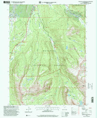
1998 Map of Christmas Meadows
USGS Topo · Published 2001About this map
The Stillwater Campground and Mirror Lake Scenic Byway mark the northern reaches of this high-altitude landscape, where the Bear River is fed by a complex system of glacial forks. This 1998 revision by the USDA Forest Service documents the protected boundaries of the High Uintas Wilderness and Wasatch National Forest, preserving a terrain defined by dramatic alpine basins like the Amethyst Basin. The central valley near Christmas Meadows serves as a primary access point for backcountry routes, including the Smiths Fork Trail.
Find a feature on this map
38 named features on this map. Tap any name to fly to it.
Don’t see what you’re looking for? This feature index may not catch every label — zoom into the map to look around manually.
Map Details
Editions of this 1998 Christmas Meadows Map
This is the sole edition of this map. No revisions or reprints were ever made.
Other maps of this area

1885 · Uinta
USGS Topo · 1:250,000

1901 · Hayden Peak
USGS Topo · 1:125,000

1903 · Hayden Peak
USGS Topo · 1:125,000

1954 · Salt Lake City
USGS Topo · 1:250,000

1958 · Salt Lake City
USGS Topo · 1:250,000

1960 · Salt Lake City
USGS Topo · 1:250,000

1967 · Explorer Peak
USGS Topo · 1:24,000
1967 · Elizabeth Mtn
USGS Topo · 1:24,000
1967 · Red Knob
USGS Topo · 1:24,000
1972 · Seven Tree Flat
USGS Topo · 1:24,000