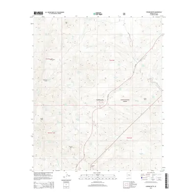
2014 Map of Chrome Butte
USGS Topo · Published 2014About this map
McMillianville sits along US Hwy 60 at the heart of this high-elevation terrain within the Tonto National Forest. The landscape is defined by its numerous springs and drainage systems, such as Sevenmile Wash and Nugget Wash, which reveal the critical importance of water management in this arid region. High points like Apache Peaks and Richmond Mtn provide significant relief, while isolated features such as Chrome Butte and Chalky Butte serve as distinct navigational markers across the territory.
Find a feature on this map
54 named features on this map. Tap any name to fly to it.
Don’t see what you’re looking for? This feature index may not catch every label — zoom into the map to look around manually.
Map Details
Editions of this 2014 Chrome Butte Map
This is the sole edition of this map. No revisions or reprints were ever made.
Other maps of this area

1901 · Globe
USGS Topo · 1:62,500

1902 · Globe
USGS Topo · 1:62,500

1922 · Chrysotile
USGS Topo · 1:125,000

1945 · Globe
USGS Topo · 1:24,000

1949 · Rockinstraw Mtn
USGS Topo · 1:62,500

1950 · Rockinstraw Mtn
USGS Topo · 1:62,500

1954 · Mesa
USGS Topo · 1:250,000

1957 · Mesa
USGS Topo · 1:250,000

1958 · Mesa
USGS Topo · 1:250,000

1960 · Mesa
USGS Topo · 1:250,000