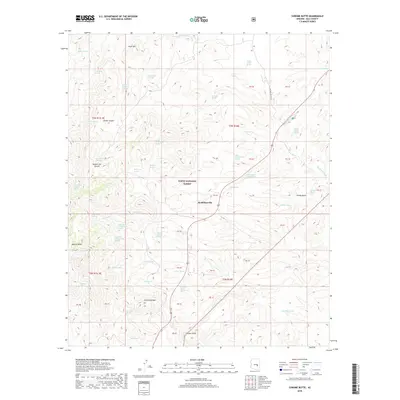
2018 Map of Chrome Butte
USGS Topo · Published 2018About this map
McMillianville sits at the heart of this high-desert landscape within the Tonto National Forest. The terrain is defined by dramatic peaks and deep canyons, including the prominent Chrome Butte and the high ridges of Richmond Mtn and Apache Peaks. This area is characterized by a high density of named water sources, essential for survival and ranching in this arid Gila County environment. Numerous springs, such as Indian Garden Spring and Coburn Spring Number Two, are scattered throughout the hills, many bearing the names of local figures or descriptive traits like Stutter Spring and Slinkard Spring. A network of backroads, such as Haystack Butte Rd, provides the only access through the winding geography of Yankee Joe Canyon and the rocky outcrops of Chalky Butte. The map illustrates a landscape where seasonal water and topographic relief dictate the placement of human tracks and small outposts.
Find a feature on this map
57 named features on this map. Tap any name to fly to it.
Don’t see what you’re looking for? This feature index may not catch every label — zoom into the map to look around manually.
Map Details
Editions of this 2018 Chrome Butte Map
This is the sole edition of this map. No revisions or reprints were ever made.
Other maps of this area

1901 · Globe
USGS Topo · 1:62,500

1902 · Globe
USGS Topo · 1:62,500

1922 · Chrysotile
USGS Topo · 1:125,000

1945 · Globe
USGS Topo · 1:24,000

1949 · Rockinstraw Mtn
USGS Topo · 1:62,500

1950 · Rockinstraw Mtn
USGS Topo · 1:62,500

1954 · Mesa
USGS Topo · 1:250,000

1957 · Mesa
USGS Topo · 1:250,000

1958 · Mesa
USGS Topo · 1:250,000

1960 · Mesa
USGS Topo · 1:250,000