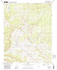
1984 Map of Chromo
USGS Topo · Published 1988About this map
Chromo and the high-altitude landscapes of southern Colorado are captured here just north of the New Mexico border. The settlement of Vigil lies to the south, while the rugged terrain of the San Juan National Forest dominates the northern half of the sheet. This area is defined by the convergence of the Navajo River and the Little Navajo River, supported by water management features like Little Oso Dam and the Spence Reservoir.
Find a feature on this map
44 named features on this map. Tap any name to fly to it.
Don’t see what you’re looking for? This feature index may not catch every label — zoom into the map to look around manually.
Map Details
Editions of this 1984 Chromo Map
2 editions found
Other maps of this area

1913 · Summitville
USGS Topo · 1:125,000

1915 · Summitville
USGS Topo · 1:125,000

1945 · Durango
USGS Topo · 1:250,000

1953 · Durango
USGS Topo · 1:250,000

1954 · Durango
USGS Topo · 1:250,000

1954 · Aztec
USGS Topo · 1:250,000

1955 · Chama
USGS Topo · 1:62,500

1955 · Lumberton
USGS Topo · 1:62,500

1957 · Chromo
USGS Topo · 1:62,500

1957 · Chama Peak
USGS Topo · 1:62,500