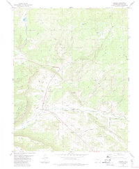
1984 Map of Chromo
USGS Topo · Published 1984About this map
The Navajo River and Little Navajo River converge in this high-altitude landscape within the San Juan National Forest near the small settlement of Chromo. The map reveals a complex water management system vital for ranching and agriculture in this arid environment, evidenced by an extensive network of irrigation canals like the Midland Ditch, Enterprise Ditch, and Southside Ditch. These waterways support the livestock operations below the prominent plateaus of Mesa Cortado and Vigil Mesa.
Find a feature on this map
54 named features on this map. Tap any name to fly to it.
Don’t see what you’re looking for? This feature index may not catch every label — zoom into the map to look around manually.
Map Details
Editions of this 1984 Chromo Map
2 editions found
Other maps of this area

1913 · Summitville
USGS Topo · 1:125,000

1915 · Summitville
USGS Topo · 1:125,000

1945 · Durango
USGS Topo · 1:250,000

1953 · Durango
USGS Topo · 1:250,000

1954 · Durango
USGS Topo · 1:250,000

1954 · Aztec
USGS Topo · 1:250,000

1955 · Chama
USGS Topo · 1:62,500

1955 · Lumberton
USGS Topo · 1:62,500

1957 · Chromo
USGS Topo · 1:62,500

1957 · Chama Peak
USGS Topo · 1:62,500