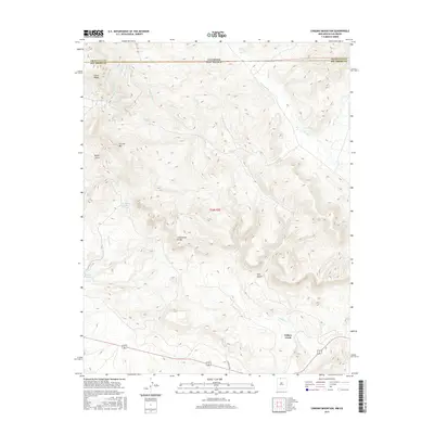
2017 Map of Chromo Mountain
USGS Topo · Published 2017About this map
The Continental Divide defines the spine of this high-elevation landscape, where the state line between Colorado and New Mexico meets the boundary of Archuleta and Rio Arriba counties. At the heart of the terrain, Chromo Mountain rises above a complex drainage system that feeds the Rio Chamita and the extensive network of Willow Creek. The southern portion of the map reveals the small settlement of Willow Creek, situated near where the Azotea Tunnel (labeled also as Azotea Tun) suggests mid-century water management infrastructure cutting through the mountains. Dozens of small water bodies and seasonal flows, such as Beaver Lake, Clydes Corral Lake, and Las Ranas Lake, are scattered across the high basins. These landmarks, along with Stove Ridge and Tuck Canyon, provide critical orientation for those studying the hydrologic and geographic transitions of the San Juan Mountains region.
Find a feature on this map
24 named features on this map. Tap any name to fly to it.
Don’t see what you’re looking for? This feature index may not catch every label — zoom into the map to look around manually.
Map Details
Editions of this 2017 Chromo Mountain Map
This is the sole edition of this map. No revisions or reprints were ever made.
Other maps of this area

1913 · Summitville
USGS Topo · 1:125,000

1915 · Summitville
USGS Topo · 1:125,000

1945 · Durango
USGS Topo · 1:250,000

1953 · Durango
USGS Topo · 1:250,000

1954 · Durango
USGS Topo · 1:250,000

1954 · Aztec
USGS Topo · 1:250,000

1955 · Chama
USGS Topo · 1:62,500

1955 · Lumberton
USGS Topo · 1:62,500

1957 · Chromo
USGS Topo · 1:62,500

1957 · Chama Peak
USGS Topo · 1:62,500