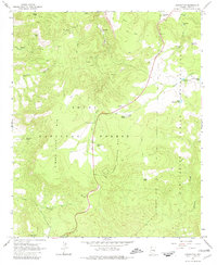
1966 Map of Chrysotile
USGS Topo · Published 1981About this map
Chrysotile and the surrounding Gila County landscape are defined by the sharp transition between the Tonto National Forest and the San Carlos Indian Reservation. This mid-1960s survey captures an area where industry and natural resources intersect, evidenced by the numerous prospect sites and a primary Mine located in the northwest near Cypress Tank. The rugged topography is etched with drainage systems like Ash Creek and Cienega Creek, the latter featuring a series of catchments including Detention No 6. Human activity is concentrated along a winding road passing the Timber Camp area and a designated Picnic Area, while the lower elevations are marked by landmarks like Jackson Butte and Hess Canyon. The map reveals a network of Jeep Trails providing access to remote water sources such as New Corral Spring and Sanders Spr, which were vital for supporting the settlement and ranching efforts of the era.
Find a feature on this map
36 named features on this map. Tap any name to fly to it.
Don’t see what you’re looking for? This feature index may not catch every label — zoom into the map to look around manually.
Map Details
Editions of this 1966 Chrysotile Map
3 editions found
Other maps of this area

1922 · Chrysotile
USGS Topo · 1:125,000

1946 · Blue House Mtn
USGS Topo · 1:62,500

1951 · Blue House Mtn
USGS Topo · 1:62,500

1954 · Mesa
USGS Topo · 1:250,000

1957 · Mesa
USGS Topo · 1:250,000

1958 · Mesa
USGS Topo · 1:250,000

1960 · Mesa
USGS Topo · 1:250,000

1964 · Mesa
USGS Topo · 1:250,000

1966 · Brushy Canyon
USGS Topo · 1:24,000

1966 · Cassadore Spring
USGS Topo · 1:24,000