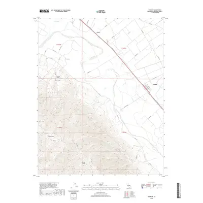
2018 Map of Chualar
USGS Topo · Published 2018About this map
The Salinas River valley floor transitions into the steep eastern slopes of the Sierra de Salinas in this 2018 survey. The settlement of Chualar sits as a central hub along the historic corridor of El Camino Real S, where the flat agricultural bottomlands meet a grid of local roads like Chualar Rd and Foletta Rd. To the northwest, the community of Spence marks the approach toward the larger Salinas area, situated near the Alisal Slough. The landscape is defined by the contrast between the intensive irrigation of the valley and the deeply etched drainage systems of the mountains, including Parker Canyon, Kelte Canyon, and Calera Canyon. High points like Mt Toro overlook the winding course of the river, while seasonal waterways such as Chualar Cr and Limekiln Cr provide a complex hydrological profile of the Monterey County interior.
Find a feature on this map
44 named features on this map. Tap any name to fly to it.
Don’t see what you’re looking for? This feature index may not catch every label — zoom into the map to look around manually.
Map Details
Editions of this 2018 Chualar Map
This is the sole edition of this map. No revisions or reprints were ever made.
Other maps of this area

1910 · Gonzales
USGS Topo · 1:31,680

1910 · Salinas
USGS Topo · 1:31,680

1910 · Soledad
USGS Topo · 1:31,680

1912 · Salinas
USGS Topo · 1:62,500

1915 · Soledad
USGS Topo · 1:62,500

1920 · Jamesburg
USGS Topo · 1:48,000

1921 · Jamesburg
USGS Topo · 1:62,500

1921 · Gonzales
USGS Topo · 1:62,500

1939 · Jamesburg
USGS Topo · 1:62,500

1940 · Salinas
USGS Topo · 1:62,500