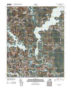
2010 Map of Chuckatuck
USGS Topo · Published 2010About this map
The Nansemond River winds through this coastal Virginia landscape, creating a complex geography of points and landings including Glebe Point, Hollidays Point, and Wilkerson Landing. The settlement at Chuckatuck remains a central hub, supported by the Chuckatuck Post Office and nearby industrial and infrastructure markers like the Godwins Millpond Dam. This area exhibits a distinct pattern of historical occupation along the riverbanks, evidenced by numerous named landings and wharves such as Ferry Point Wharf and Trotman Wharf.
Find a feature on this map
140 named features on this map. Tap any name to fly to it.
Don’t see what you’re looking for? This feature index may not catch every label — zoom into the map to look around manually.
Map Details
Editions of this 2010 Chuckatuck Map
This is the sole edition of this map. No revisions or reprints were ever made.
Other maps of this area

1907 · Norfolk
USGS Topo · 1:125,000

1919 · Smithfield
USGS Topo · 1:62,500

1919 · Suffolk
USGS Topo · 1:62,500

1921 · Newport News
USGS Topo · 1:62,500

1940 · Lake Drummond
USGS Topo · 1:62,500

1944 · Windsor
USGS Topo · 1:31,680

1944 · Smithfield
USGS Topo · 1:24,000

1945 · Lake Drummond
USGS Topo · 1:62,500
1945 · Smithfield
USGS Topo · 1:31,680

1949 · Chuckatuck
USGS Topo · 1:24,000