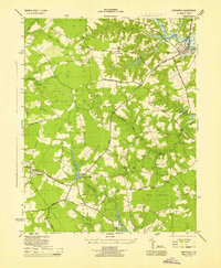
1945 Map of Smithfield
USGS Topo · Published 1945About this map
The Pagan River winds toward the settlement of Smithfield in this mid-1940s survey of Isle of Wight County, where the Tidewater landscape is defined by its drainage basins and rural road networks. The inland territory is divided between the Hardy and Newport districts, anchored by the Isle of Wight Courthouse and a cluster of small communities such as Comet, Magnet, and Central Hill. The distribution of rural landmarks reflects a deeply established social fabric, with numerous local institutions like Trinity Sch, Emanuel Ch, and Bethel Ch serving the surrounding farms.
Find a feature on this map
44 named features on this map. Tap any name to fly to it.
Don’t see what you’re looking for? This feature index may not catch every label — zoom into the map to look around manually.
Map Details
Editions of this 1945 Smithfield Map
This is the sole edition of this map. No revisions or reprints were ever made.
Other maps of this area

1907 · Yorktown
USGS Topo · 1:62,500

1919 · Smithfield
USGS Topo · 1:62,500

1919 · Surry
USGS Topo · 1:62,500

1920 · Ivor
USGS Topo · 1:62,500

1943 · Yorktown
USGS Topo · 1:62,500

1943 · Richmond
USGS Topo · 1:250,000

1944 · Windsor
USGS Topo · 1:31,680

1944 · Smithfield
USGS Topo · 1:24,000

1944 · Raynor
USGS Topo · 1:24,000

1944 · Zuni
USGS Topo · 1:24,000