
1949 Map of Chuckatuck
USGS Topo · Published 1949About this map
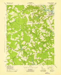
Chuckatuck serves as a central hub for this Tidewater landscape during the late 1940s, situated at the confluence of several major county roads including Crittenden Road and Chuckatuck Road. The area is defined by the winding course of the Nansemond River and its numerous creeks and coves, such as Wills Cove and Chuckatuck Cr. Significant for local historians, the map identifies numerous rural institutions like the Rosenwald School and St Johns Ch, reflecting the community structure of Isle of Wight Co and Nansemond Co at this time. Evidence of the region's transport and utility infrastructure is clear, with five different railroad lines—including the Southern and the Atlantic Coast Line—traversing the southern and eastern reaches, alongside more modern additions like the Underground Water Pipe Line and the Wlpm Radio Tower near Elephant Fork. Small crossroads like Wiles Corner and Sandy Bottom punctuate the landscape of swamps and timbered necks.
Find a feature on this map
88 named features on this map. Tap any name to fly to it.
Don’t see what you’re looking for? This feature index may not catch every label — zoom into the map to look around manually.
Map Details
Editions of this 1949 Chuckatuck Map
This is the sole edition of this map. No revisions or reprints were ever made.
Other maps of this area

1907 · Norfolk
USGS Topo · 1:125,000

1919 · Smithfield
USGS Topo · 1:62,500

1919 · Suffolk
USGS Topo · 1:62,500

1921 · Newport News
USGS Topo · 1:62,500

1940 · Lake Drummond
USGS Topo · 1:62,500

1944 · Windsor
USGS Topo · 1:31,680

1944 · Smithfield
USGS Topo · 1:24,000

1945 · Lake Drummond
USGS Topo · 1:62,500
1945 · Smithfield
USGS Topo · 1:31,680
1950 · Blackstone
USGS Topo · 1:24,000