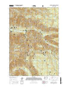
2017 Map of Chucksney Mountain
USGS Topo · Published 2017About this map
Willamette National Forest serves as the backdrop for this 2017 survey, where high mountain ridges divide significant watersheds of the Oregon Cascades. The northern portion of the map is defined by the S Fork McKenzie River and the high-elevation crossing at Frissell Crossing. Further south, the terrain rises toward Chucksney Mountain and the prominent Roaring River Ridge, which overlooks the winding course of the Roaring River. This high-country landscape is defined by its water sources, from Beeler Spring to the headwaters of French Pete Cr. Near the southern boundary, the map captures the steep descent into Box Canyon and the upper reaches of the N Fork Middle Fork Willamette River. The area remains largely defined by forest service infrastructure, including Natl Forest Develop Road 19 Rd and remote outposts like Reilly Meadows.
Find a feature on this map
42 named features on this map. Tap any name to fly to it.
Don’t see what you’re looking for? This feature index may not catch every label — zoom into the map to look around manually.
Map Details
Editions of this 2017 Chucksney Mountain Map
This is the sole edition of this map. No revisions or reprints were ever made.
Other maps of this area

1925 · Waldo Lake
USGS Topo · 1:125,000

1929 · Three Sisters
USGS Topo · 1:125,000

1930 · Maiden Peak
USGS Topo · 1:125,000

1932 · Three Sisters
USGS Topo · 1:125,000

1934 · Maiden Peak
USGS Topo · 1:125,000

1934 · Mc Kenzie Bridge
USGS Topo · 1:96,000

1940 · Mc Kenzie Bridge
USGS Topo · 1:125,000

1953 · Salem
USGS Topo · 1:250,000

1954 · Salem
USGS Topo · 1:250,000

1955 · Chucksney Mtn
USGS Topo · 1:62,500