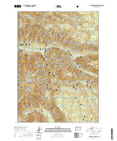
2020 Map of Chucksney Mountain
USGS Topo · Published 2020About this map
Willamette National Forest encompasses this section of the Cascade Range, dominated by the high ridgelines of Chucksney Mountain and Roaring River Ridge. The drainage patterns here are distinct, with the S Fork McKenzie River cutting through the northern portion near the Frissell Crossing settlement. To the south, the North Fork Middle Fork Willamette Wild and Scenic River defines the landscape's lower boundary. This protected corridor includes diverse water sources like Beeler Spring and numerous creeks such as French Pete Cr and Moolack Cr. The topographical detail highlights significant landmarks like Rebel Rock and Box Canyon, alongside the high-elevation Reilly Meadows. The presence of the Crossing Way trail suggests the enduring importance of established paths through these steep forested divides.
Find a feature on this map
38 named features on this map. Tap any name to fly to it.
Don’t see what you’re looking for? This feature index may not catch every label — zoom into the map to look around manually.
Map Details
Editions of this 2020 Chucksney Mountain Map
This is the sole edition of this map. No revisions or reprints were ever made.
Other maps of this area

1925 · Waldo Lake
USGS Topo · 1:125,000

1929 · Three Sisters
USGS Topo · 1:125,000

1930 · Maiden Peak
USGS Topo · 1:125,000

1932 · Three Sisters
USGS Topo · 1:125,000

1934 · Maiden Peak
USGS Topo · 1:125,000

1934 · Mc Kenzie Bridge
USGS Topo · 1:96,000

1940 · Mc Kenzie Bridge
USGS Topo · 1:125,000

1953 · Salem
USGS Topo · 1:250,000

1954 · Salem
USGS Topo · 1:250,000

1955 · Chucksney Mtn
USGS Topo · 1:62,500