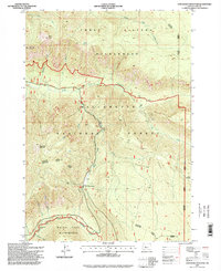
1997 Map of Chucksney Mountain
USGS Topo · Published 1998About this map
The Willamette National Forest dominates this high-country landscape, where the headwaters of the South Fork McKenzie River and the Middle Fork Willamette River are separated by the massive bulk of Chucksney Mountain. The terrain is defined by wilderness management, with the Three Sisters Wilderness to the north and Waldo Lake Wilderness to the south. This late-twentieth-century survey reveals a landscape focused on conservation and backcountry recreation, connected by the Robert Aufderheide Memorial Drive, which serves as a Scenic Byway through the river corridors.
Find a feature on this map
30 named features on this map. Tap any name to fly to it.
Don’t see what you’re looking for? This feature index may not catch every label — zoom into the map to look around manually.
Map Details
Editions of this 1997 Chucksney Mountain Map
This is the sole edition of this map. No revisions or reprints were ever made.
Other maps of this area

1925 · Waldo Lake
USGS Topo · 1:125,000

1929 · Three Sisters
USGS Topo · 1:125,000

1930 · Maiden Peak
USGS Topo · 1:125,000

1932 · Three Sisters
USGS Topo · 1:125,000

1934 · Maiden Peak
USGS Topo · 1:125,000

1934 · Mc Kenzie Bridge
USGS Topo · 1:96,000

1940 · Mc Kenzie Bridge
USGS Topo · 1:125,000

1953 · Salem
USGS Topo · 1:250,000

1954 · Salem
USGS Topo · 1:250,000

1955 · Chucksney Mtn
USGS Topo · 1:62,500