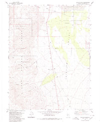
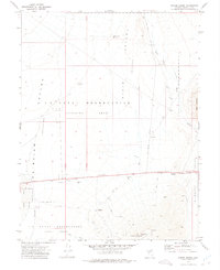
1980 Map of Chukar Canyon
USGS Topo · Published 1980About this map
The U S Naval Reservation (Target Area) dominates this high-desert landscape in Churchill County, marking a period of significant military presence in the Great Basin. This mid-1970s topographical record illustrates a stark, arid environment characterized by the Fairview Valley (Depression) and the Labou Flat playa. The convergence of the Stillwater Range and the Sand Springs Range creates a complex system of drainages, including Chukar Canyon, Red Top Canyon, and Lucky Boy Canyon. Sparse human activity is recorded through several Borrow Pits, a small Prospect, and a scattered network of Jeep Trails. Water sources are notably rare in this terrain, with only South Well, a single Spring, and one other Well indicated across the entire quadrangle, emphasizing the desert's isolation and the importance of specific landmarks for navigation.
Find a feature on this map
18 named features on this map. Tap any name to fly to it.
Don’t see what you’re looking for? This feature index may not catch every label — zoom into the map to look around manually.
Map Details
Editions of this 1980 Chukar Canyon Map
2 editions found
Other maps of this area

1908 · Carson Sink
USGS Topo · 1:250,000

1910 · Carson Sink
USGS Topo · 1:250,000

1957 · Reno
USGS Topo · 1:250,000

1959 · Reno
USGS Topo · 1:250,000

1960 · Reno
USGS Topo · 1:250,000

1972 · Fourmile Flat
USGS Topo · 1:24,000
1972 · Slate Mtn
USGS Topo · 1:24,000
1972 · Bell Canyon
USGS Topo · 1:24,000
1972 · Drumm Summit
USGS Topo · 1:24,000
1972 · Frenchman
USGS Topo · 1:24,000