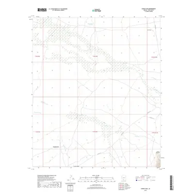
2018 Map of Chukut Kuk
USGS Topo · Published 2018About this map
Chukut Kuk sits within a landscape defined by seasonal watercourses and desert valleys in southern Arizona. The settlement's connection to the terrain is evident in the drainage patterns of Chukut Kuk Wash and the prominent Big Wash, which influence the local geography. The desert floor is divided by the Sells Valley and Tecolote Valley, showing a sparse but vital network of infrastructure such as Ind Ser Rt 12 and Indian Rte 20. To the southeast, the Alvarez Mountains provide a significant topographical boundary, while the Pablos Charco Reservoir indicates the critical importance of water management in this arid environment. This 2018 survey captures the intersection of traditional land use and modern tribal routes within Pima County.
Find a feature on this map
18 named features on this map. Tap any name to fly to it.
Don’t see what you’re looking for? This feature index may not catch every label — zoom into the map to look around manually.
Map Details
Editions of this 2018 Chukut Kuk Map
This is the sole edition of this map. No revisions or reprints were ever made.
Other maps of this area

1941 · Vamori
USGS Topo · 1:62,500

1941 · Sells
USGS Topo · 1:62,500

1943 · Sells
USGS Topo · 1:62,500

1943 · Fresnal
USGS Topo · 1:125,000

1943 · Vamori
USGS Topo · 1:62,500

1954 · Sonoyta
USGS Topo · 1:250,000

1956 · Nogales
USGS Topo · 1:250,000

1958 · Nogales
USGS Topo · 1:250,000

1959 · Nogales
USGS Topo · 1:250,000

1963 · Gu Oidak
USGS Topo · 1:62,500